東京都内と近畿の大阪間を走る夜行バスの比較を行う
夜行バスは格安の値段で各地域を行き来できるサービスです。東京から関西地方に遊びに行ったり、実家に帰る際に活躍します。大阪の街より都内観光や出張に行く際にも大変重宝します。出費が増える大型連休の時期でも夜行バスならお財布に優しく、ユーザー側から費用対効果が良い便を探していけます。
定番の遠距離の移動手段である新幹線や飛行機よりも夜行バスはコストパフォーマンスが高いといえるでしょう。ぐっすりと眠って目指す街まで動ける点も夜行バスの長所です。ホテル代をゼロに出来たり、旅先での乗換時刻表を検索する等の手間も省けます。
夜行バスの情報収集なら是非当サイトをご活用ください。初心者の方からベテランユーザーの方々まで役立つ情報を掲載しています。比較検討の時間はとにかく節約したいけれど下調べは丁寧に進めたいという方はぜひ参考にしてください。
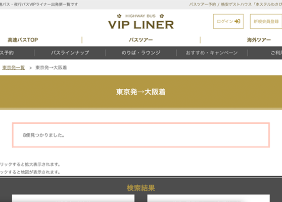
VIP LINER
POINT
- アイコン表示でバスごとの特徴を確認できる
- 座席指定プランでは窓側・通路側など好きな席を選べる
- チャットで気軽に問い合わせができる
夜行バスを選ぶ際、複数の選択肢があるとどのような違いがあるかわからず迷ってしまうこともあるでしょう。VIP LINERでは、東京から大阪へ移動する夜行バスごとの特徴がわかりやすいように、アイコン表示で特徴を示しています。
窓際の席や通路側の席がいいという場合、VIP LINERの座席指定プランでは窓際や通路側など座席を指定して予約可能です。また女性専用のバスもあるため、異性が周囲にいると不安な方も安心して利用できます。
気になる点があって問い合わせがしたくても、電話やメールは面倒といった方もいるでしょう。VIP LINERではチャットで問い合わせが可能なので、気軽に質問をしたい方も利用しやすくなっています。
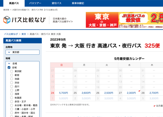
バス比較なび
POINT
- 学割などの割引にも対応した価格表示
- バスごとの特徴が明記されているので比較しやすい
- 予約サイトが複数掲載されているので比較しやすい
少しでも安く夜行バスに乗車したいと考えている場合、学割や特割などの割引制度を活用することが大切です。バス比較なびでは、東京から大阪へ行く便において、学割や特割なども案内されているので、割引価格で乗車できる便を探しやすいという特徴があげられます。
消毒や消臭に関する対策、足元が広々としているか、充電器は用意されているのかなどの便ごとの特徴が文章で書かれています。1便ずつ特徴を比較することで、自分に合った便を探しやすいのもバス比較なびにおける特徴の1つです。
実際に東京から大阪への便探しで、どの予約サイトから予約するのがいいか迷ってしまうこともあるでしょう。バス比較なびでは、複数の予約サイトを提示しているので、比較しながら予約サイトを選択できます。
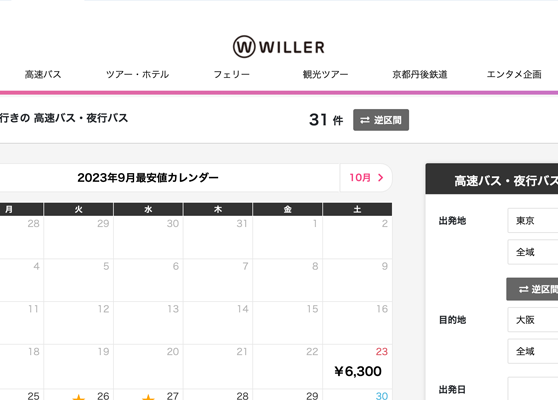
WILLER
POINT
- 複数の座席プランから希望に合わせて選択可能
- 4列シートでも個室感があるので安心
- 充電OKやトイレ付きの車両も充実
4列シートで隣が男性だと不安という方は、WILLERの夜行バスで女性専用席を選ぶことも可能です。また夜行バスの種類によっては、観光バスシートタイプのリーズナブルなプランもあるため、希望に合わせてプランの選択ができます。
4列シートであっても個室感がある中で利用できるように、寝顔を隠せるカノピー(フード)の設備が用意されています。さらにWILLERでは大きなパーテーションを使って仕切ることも可能なため、隣を気にせずリラックスできるようになっています。
東京から大阪まで8時間近くかかる移動時間を快適に過ごせるように、車内トイレや各座席コンセント、フリーWi-Fiなどの設備が用意されている車両もあります。夜行バスごとにどのような設備が用意されているのか記載されているため、情報を参考に便を選びましょう。
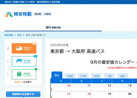
格安移動
POINT
- 国内移動比較ページなら3つの乗り物の情報が一括比較できる
- 気になる情報はお気に入り機能で保存が可能
- 最安値比較速報でその月の最安値がすぐにわかる
東京から大阪間などの国内の移動には夜行バスが便利です。格安移動では、高速バスだけではなく飛行機や新幹線など3つの乗り物の最安値情報を調べることができます。最安値カレンダーに表示されている価格は諸費用込みの総額表示となっています。
多くの高速バス・夜行バス比較サイトではログインが必要です。格安移動ではログインの手間なく必要なときにすぐに利用できます。気になる情報はお気に入り機能で保存も可能で、履歴も10件まで残せるようになっています。
格安移動では毎月の最安値比較速報を用意しているので、東京から大阪間の夜行バスの最安値情報をすぐに知ることができます。逆区間からの最安値情報にもすぐに切り替えられるのも便利です。
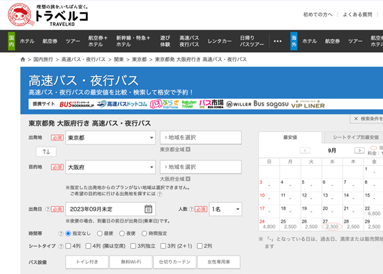
トラベルコ
POINT
- 夜行バスはもちろんホテルや航空券の最安値の確認にも便利
- 日帰りバスツアーをまとめて比較できる
- 細かく地域を選択して検索できる
トラベルコは国内でも最大級の夜行バス比較サイトで、1500社以上の予約サイトから比較することができます。それゆえに、他のバス予約サイトよりも最安値情報を見つけやすいと評判です。夜行バスや高速バスはもちろん、ホテルやツアー・航空券などの最安値検索にも役立ちます。
バスツアーは日帰りで参加できるものも人気です。トラベルコでは日帰りバスツアーの情報も満載で、人気の日帰りバスツアーを手軽に検索・比較することができます。東京や大阪の人気テーマランキングや人気バスツアーランキングを見れば、すぐに人気のツアーがわかります。
東京から大阪間の夜行バスは実に多く用意されていますが、トラベルコでは地域や目的地を細かく指定して検索することができます。すべての商品から検索できることはもちろん、空席確認済みの商品からも検索可能です。
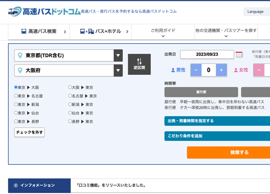
高速バスドットコム
POINT
- 全国各地の高速バスや夜行バスの情報が網羅されている
- 細かい条件指定で高速バスを探せる
- 最安値料金がわかるから選びやすい
全国で数多くの高速バスが走っているため、お得なバス、設備が充実しているバスは多々あります。それを一括で調べられるサービスが高速バスドットコムです。情報収集や予約が高速バスドットコム1つで済んでしまうので便利です。
扱っている夜行バスの便数も豊富で、人気のある東京と大阪間も比較ができて、自分の好みの便を選ぶことが可能です。出発地と目的地だけで絞るのではなく、出発や到着時間帯、シート数、さらに支払い方法など細かく条件を絞って検索も可能です。
多くの高速夜行バスを扱っているだけに、バス会社も多数存在します。そこで役立つのが口コミ機能です。利用者からの声が寄せられているので、それを参考にして安心快適なバスを選べます。もちろん自分が利用してから口コミを投稿することもできます。
長旅の移動手段として夜行バスはコスパ面が優秀です
鉄道は会社員や大学生にとってお馴染みの乗り物です。短距離ならお得に移動出来る手段ですが、東京から大阪といった遠距離の場合はコスパが落ちます。また新幹線に乗り込める駅は限られており、若干不便です。その駅まで移動する事自体にお金や時間が掛かります。お得に便利に東京と大阪を行き来したい時は夜行バスがおすすめです。夜行バスなら手軽な場所から乗車出来ますし、他のサービスに比べてコスパの面がかなり有能です。色々な出費が重なりお財布が若干厳しい時も夜行バスなら無理する事無く東京や大阪へ向かえます。世間的に夜行バスはポピュラーな乗り物になっており、選べる便が更に充実して来ました。行き先が同じ便でも、運営する会社によって座席の仕様や具体的な料金は変わる為、前もって細かい情報を集めておきたいところです。
東京の秋葉原はまさしく国際的に有名なサブカルチャーの発信地です。最近では文字通り世界中のアニメファンやゲームファンが東京を訪れています。東京の大型店に行かなければゲット出来ない特典があったり、関東限定のイベントなども珍しくありません。夜行バスを使えばグッズ代やイベントの費用を上手く温存しながら関東と関西を行き来できます。若者に嬉しい移動手段の代名詞でもあり、観光客が増加する旬の時期でも破格の値段で予約が行えます。大学生や大学院生の場合、実際問題として平日や普通の土日に長旅の予定は作れず、どうしても夏休みや春休みになりがちです。そんな観光シーズンでも夜行バスなら席が確保しやすく、お得な便がネットの比較検討で探せます。
大阪と言えばエンタメや食文化の豊かさに定評があります。数ある地方の大都市の中でも、ひと際知名度が高く、関東在住の人でも大阪名物や名所には詳しいかもしれません。特に最近では大阪の大人気テーマパークが若者や家族連れに大人気です。鉄道や飛行機など関東からのアクセス方法は豊富ですが、どれも値段の高さがネックです。せっかく夢の大阪旅行が出来ても交通費が掛かり過ぎてはテーマパークや飲食店で使えるお小遣いが心細くなります。コスパを最重視して大阪に行きたい際は夜行バスです。夜行バスなら便利なスポットより乗車でき、一気に旅先までたどり着けます。一泊しながら移動出来る点は夜行バスのメリットで、宿泊費もコストカットできます。お得な各種割引の対象になれば更にお得な値段で予約可能です。